
What’s the Highest Elevation Point in Every State?
Exploring the highest points in each of the 50 states offers a unique way to see America from its greatest heights. Whether standing atop the rugged peaks of Alaska’s Denali or witnessing the serene views from Florida’s Britton Hill, this guide takes you on a tour of the most elevated spots across the country.
Perfect for adventurers, hikers, and anyone curious about the natural landmarks that define each state, we dive into what makes these highpoints not just geographically significant, but also rich in history, ecology, and breathtaking views.
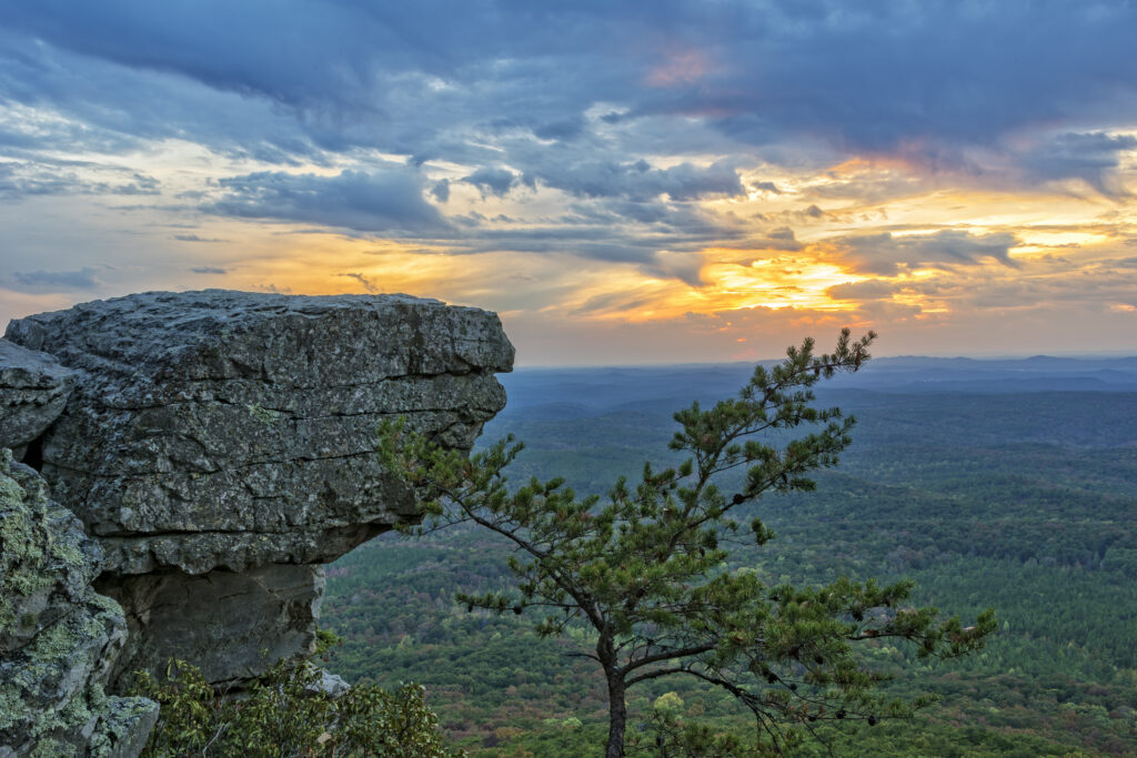
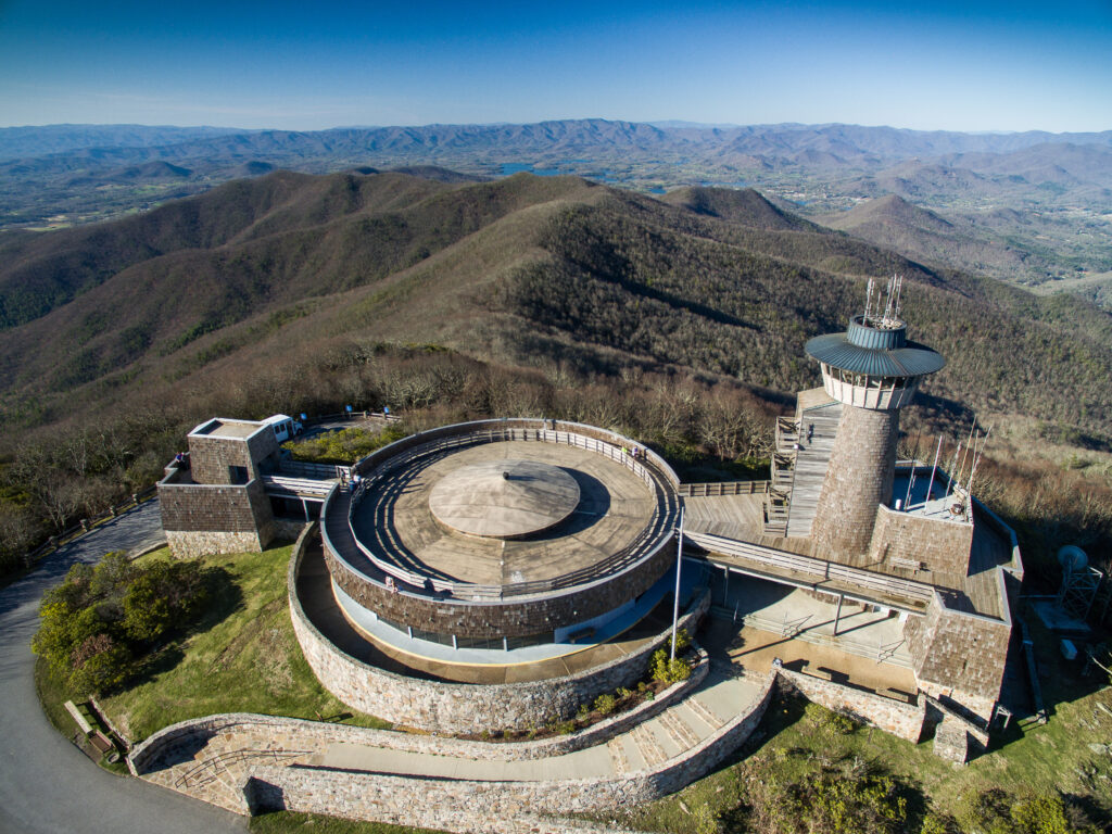
Alabama | Cheaha Mountain
2,407 feet
Cheaha Mountain, nestled within Cheaha State Park, stands as Alabama’s pinnacle of elevation. The Creek Indians, who originally named it ‘cheaha’ meaning high place, recognized its prominence. At its summit, visitors can find the Bunker Tower, an observation tower offering sweeping views of granite formations, wind-shaped trees, and the Appalachian Mountains. The Civilian Conservation Corps constructed this tower and other park structures in the 1930s, enhancing the park’s historical significance.
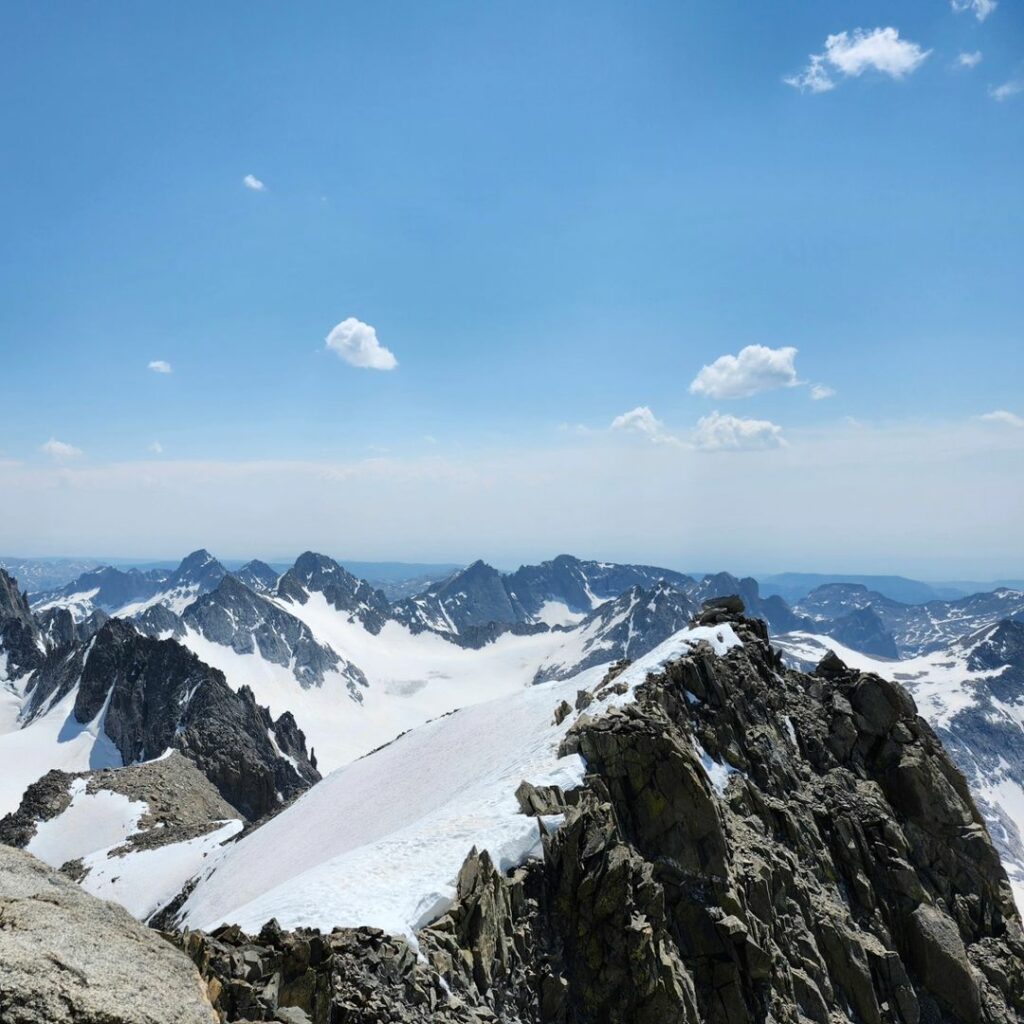
Alaska | Denali
20,310 feet
Denali towers over its namesake national park, marking the highest point in both the United States and North America. Part of the extensive Alaska Range, it’s sometimes considered the coldest mountain globally due to its extreme winds and temperatures that can plunge to -93 degrees Fahrenheit.
Fun Fact: Originally known as Mount McKinley, it was renamed in 2015 to honor the local Koyukon people’s name for it, translating to “the Great One”.
Arizona | Humphreys Peak
12,633 feet
Located in the Kachina Peaks Wilderness within the Coconino National Forest, Humphreys Peak is the apex of a cluster of dormant volcanoes known as the San Francisco Peaks in northern Arizona. The summit offers vistas stretching to iconic state landmarks like the Grand Canyon and the Painted Desert on clear days. The peak is also noted for its ancient bristlecone pines, believed to outlive any other living organism.
Arkansas | Magazine Mountain
2,753 feet
Magazine Mountain, with its distinctive flat top, serves as a sanctuary for the rare Diana fritillary butterfly and hosts an impressive 94 of the state’s 134 butterfly species. Its name has two origin tales: one from English botanist Thomas Nuttall, suggesting French hunters likened it to an ammunition store, and another attributing it to French explorers mistaking a landslide for an ammunition explosion.
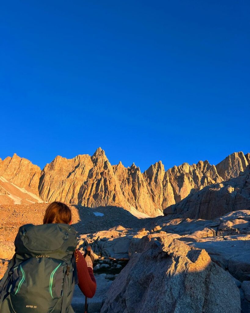
California | Mount Whitney
14,494 feet
Mount Whitney stands as the tallest peak in the contiguous United States, straddling the boundary of Sequoia National Park and Inyo National Forest. A magnet for climbers and hikers, its most direct ascent covers just over 10 miles, offering challenging yet rewarding adventures. It is also a pivotal point along the Pacific Crest Trail, attracting thousands of long-distance hikers annually.
Fun Fact: Mount Whitney – the tallest point in the lower 48 states – is less than 85 miles from the lowest point in North America, Badwater Basin in Death Valley National Park.
Colorado | Mount Elbert
14,440 feet
Mt. Elbert, the highest peak in the Rocky Mountains and the 14th tallest in the U.S., is nestled within a state renowned for its skiing destinations. Despite its grandeur, with proper acclimatization, it is deemed an accessible climb. Five routes lead to its summit, where climbers are rewarded with views of Colorado’s majestic landscapes, including the nearby Mt. Massive.
Connecticut | Mt. Frissell (Southwest Shoulder)
2,379 feet
Mt. Frissell, situated at the tri-state junction of Connecticut, New York, and Massachusetts, is part of the Taconic Range. The mountain’s south slope marks Connecticut’s highest point, even though its summit resides in Massachusetts. The Mount Frissell Trail, intersecting with the Appalachian Trail, offers hikers a unique journey through this geographically complex region.

Delaware | Ebright Azimuth
448 feet
In the flat expanses of Delaware, the Ebright Azimuth stands out not for its height but as a significant geodetic benchmark. Located near Wilmington, this point ended a long debate over Delaware’s highest elevation, a title it narrowly claims over Centerville. Marked by a simple sign and bench, it’s a humble reminder of the state’s geographic profile.
Florida | Britton Hill
345 feet
Florida’s Britton Hill, nestled within Lakewood Park in North Walton County, boasts the distinction of being the lowest highpoint among all 50 states. With its modest elevation, it offers a gentle nod to Florida’s predominantly sea-level geography and serves as a testament to the state’s subtle natural beauty.
Georgia | Brasstown Bald
4,784 feet
Brasstown Bald, the centerpiece of the Brasstown Bald Recreation Area, sits within the Chattahoochee-Oconee National Forests in northeastern Georgia. This peak is not only a visual spectacle but also a hub for leisure and learning, featuring picnic areas, an exhibition hall, and a mountaintop theater. It invites visitors to explore its surroundings and enjoy panoramic views that stretch far beyond the immediate landscape.
Hawaii | Mauna Kea
13,803 feet
At the core of Hawaii’s Big Island lies Mauna Kea, a dormant volcano that last erupted over 4,000 years ago. Its name, meaning ‘white mountain,’ references the snow that caps its summit for much of the year. As the highest point in Hawaii, Mauna Kea serves as a vital center for astronomical research, offering stargazing programs at the Maunakea Visitor Information Station to share its celestial wonders with visitors.
Idaho | Borah Peak
12,662 feet
Borah Peak, also known as Mount Borah, stands as Idaho’s tallest peak within the Lost River Range. It’s one of nine Idaho peaks surpassing 12,000 feet, distinguished not only by its height but also as the site of the state’s only active glacier. A 1983 earthquake of magnitude 6.9 added about one foot to its elevation, marking a significant moment in its geological history.

Illinois | Charles Mound
1,235 feet
Located in the Driftless Area of rural northwestern Illinois, Charles Mound represents the state’s highest natural elevation. This area’s unique geography, untouched by glaciers during the Ice Age, sets it apart. Charles Mound’s distinction as a private property highpoint limits public access, offering views across Illinois’ expansive farmland but only during specific times of the year.
Indiana | Hoosier Hill
1,257 feet
Hoosier Hill, nestled within a midwestern forest near the Indiana-Ohio state line, marks Indiana’s highest point. Situated on private land, this site commemorates Arthur H. Marshall, the first person to visit every state’s highpoint in 1936. A mailbox adorned with stickers from numerous visitors stands at the summit, bearing witness to the many highpointers who have made the journey.
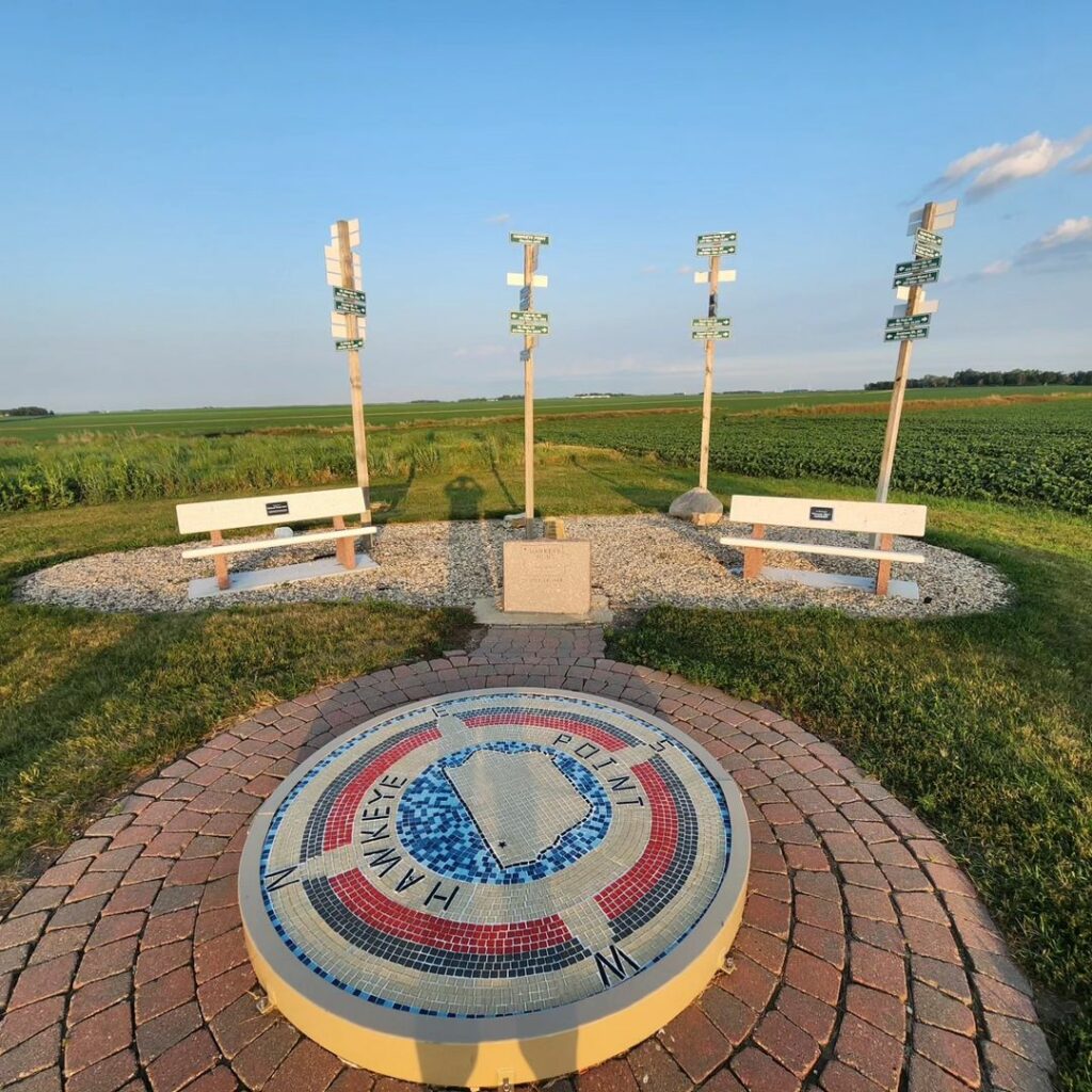
Iowa | Hawkeye Point
1,670 feet
Once a local secret, Hawkeye Point has become a celebrated stop along U.S. Route 60. Marked by a mosaic compass depicting Iowa’s map, it offers directional signs to all other state highpoints, an observation deck, and an educational exhibit. The McCallum Museum in Osceola County further enriches visitors’ understanding of this unique geographic location.
Fun Fact: Hawkeye Point is not a towering mountain but a gentle rise on a farm. The site was officially recognized and marked as the state’s highest point only after the land was donated by the Sterler family, who owned the farm, making it accessible to the public.
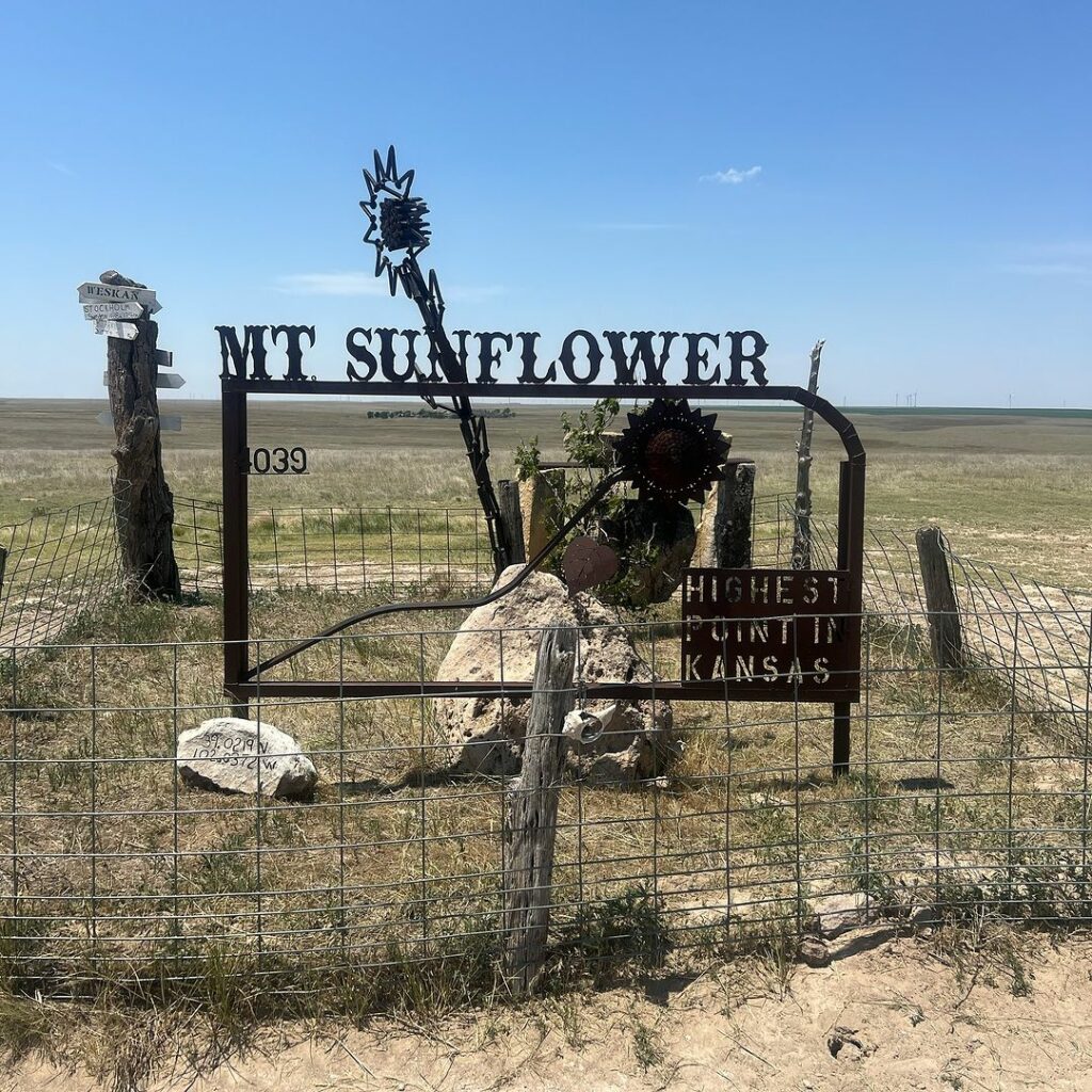
Kansas | Mount Sunflower
4,039 feet
Located on a private ranch within the High Plains of far-western Kansas, Mount Sunflower stands as the state’s apex. Despite its distance from Colorado’s towering peaks, it owes its elevation to sediment from the Rockies. Surprisingly higher than Kansas’s lowest point by 3,300 feet, it embodies the subtle diversity of the state’s landscape.
Fun Fact: There is a sunflower-shaped sign and a picnic table for visitors, making it perhaps one of the most hospitable highpoints.
Kentucky | Black Mountain
4,145 feet
Surrounded by northern hardwood forest, Kentucky’s Black Mountain rises from the Cumberland Plateau in the Appalachian Mountains’ westernmost region. Its elevation supports a diverse range of flora and fauna, making it a vital natural habitat. The surrounding region’s history of coal mining is explored in depth at the nearby Kentucky Coal Museum in Lynch.
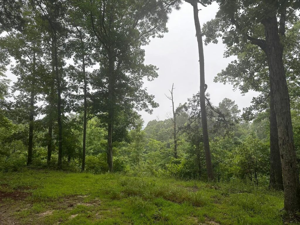
Louisiana | Driskill Mountain
535 feet
Driskill Mountain offers a serene hike through pine and hardwood forests, embellished with seasonal wildflowers. As the third lowest highpoint in the United States, it emphasizes Louisiana’s modest topography, standing shorter than the state’s tallest building, the Hancock Whitney Center in New Orleans. This mountain’s formation is a product of Paleogene sediment erosion, adding a geological note to its charm.
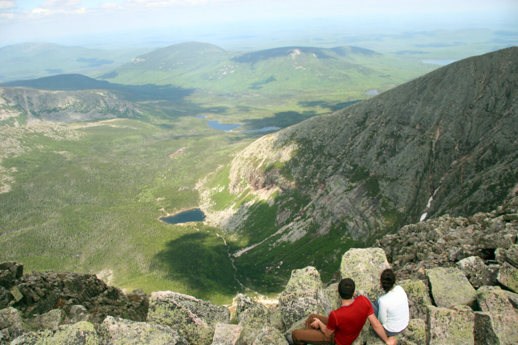
Maine | Mount Katahdin
5,269 feet
Mount Katahdin, the focal point of Baxter State Park in north-central Maine, stands as a monument to the natural beauty and wilderness of the region. Its name, given by the Penobscot people, means ‘greatest mountain,’ a testament to its sacred status among local indigenous tribes. As the northern terminus of the Appalachian Trail, it offers several challenging routes to its summit, including the Knife Edge Trail.
Maryland | Hoye-Crest
3,360 feet
Hoye-Crest, perched atop Backbone Mountain, claims the title of Maryland’s highest point. Accessible only by a trail starting in West Virginia, it offers hikers a unique cross-state journey. At the summit, a historical marker and picnic area welcome visitors, while a short path leads to an obelisk demarcating the Maryland-West Virginia state line, adding a layer of historical intrigue to the hike.
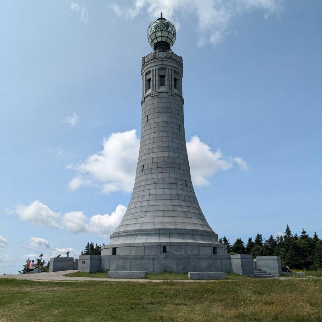
Massachusetts | Mount Greylock
3,491 feet
Mount Greylock, located within the Mount Greylock State Reservation in northwestern Massachusetts, is the state’s highest point. Accessible by a scenic byway, the summit offers far-reaching views into New York and Vermont. The area boasts over 70 miles of hiking trails, cross-country skiing, snowmobile tours, and a museum, making it a year-round destination for outdoor enthusiasts.
Michigan | Mount Arvon
1,979 feet
Mount Arvon, part of the Huron Mountains in Michigan’s Upper Peninsula, became the state’s official highpoint in 1982. It surpasses Mount Curwood by just 11 inches. A highlight of visiting this picturesque peak in Baraga County is the stunning view of Lake Superior, accessible by snowmobile or snowshoes in winter.
Fun Fact: Mount Arvon is the highest natural elevation point in Michigan, but locals will remind you that the mining waste heap in nearby Ishpeming is slightly higher, which ironically is less than a mile from Michigan’s lowest point.
Minnesota | Eagle Mountain
2,301 feet
Eagle Mountain, located deep within Minnesota’s Superior National Forest, is the state’s highest point. Accessed by the 7-mile round-trip Eagle Mountain Trail, this wilderness route is often wild and overgrown, requiring permits available at the trailhead.
Fun Fact: Confusion may arise as there’s another Eagle Mountain in northern Minnesota, part of Lutsen Mountains ski resort.
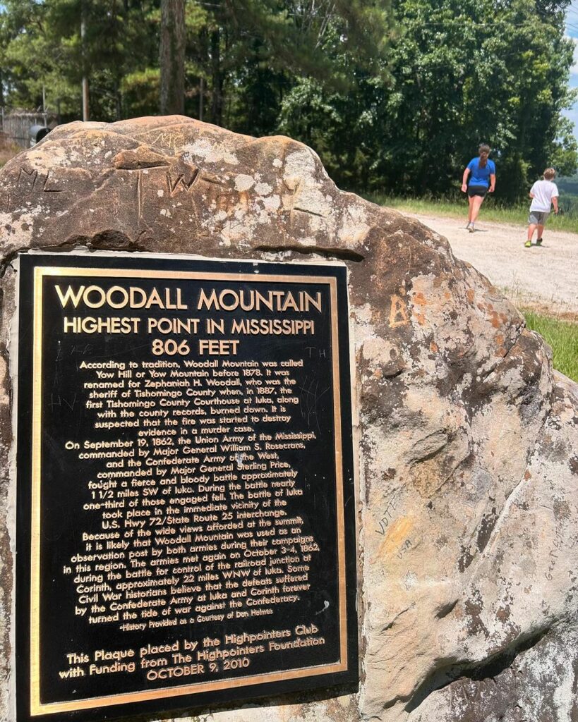
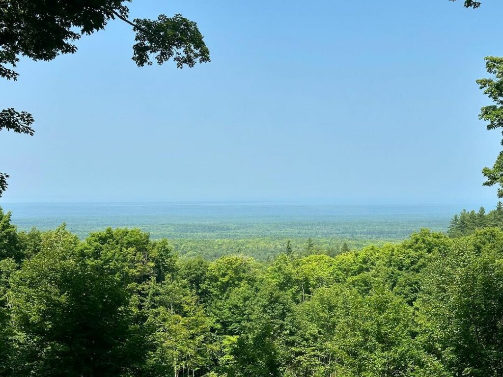
Mississippi | Woodall Mountain
806 feet
Woodall Mountain, just outside Iuka in northeastern Mississippi, is known as the “bloodiest highpoint in the United States” due to the Civil War Battle of Iuka in 1862. A plaque at the summit provides details of this significant historical event, where Union troops defeated Confederate forces, marking a pivotal moment in the area’s history.
Missouri | Taum Sauk Mountain
1,772 feet
Taum Sauk Mountain, located within the Taum Sauk Mountain State Park, stands as Missouri’s highest point. Set amidst the St. Francois Mountains, the park’s landscape is characterized by dense woodlands and rocky glades. An observation tower at the summit offers panoramic views of the lush southern Missouri countryside, with trails leading to the state’s tallest waterfall, Mina Sauk Falls.
Montana | Granite Peak
12,799 feet
Granite Peak, in the Beartooth Range of south-central Montana, epitomizes the ruggedness of the American wilderness. It is one of 28 peaks over 12,000 feet in the Absaroka-Beartooth Wilderness, extending into Wyoming. The climb to the summit is challenging, making it a coveted destination for adventurers since its first recorded ascent in 1923.
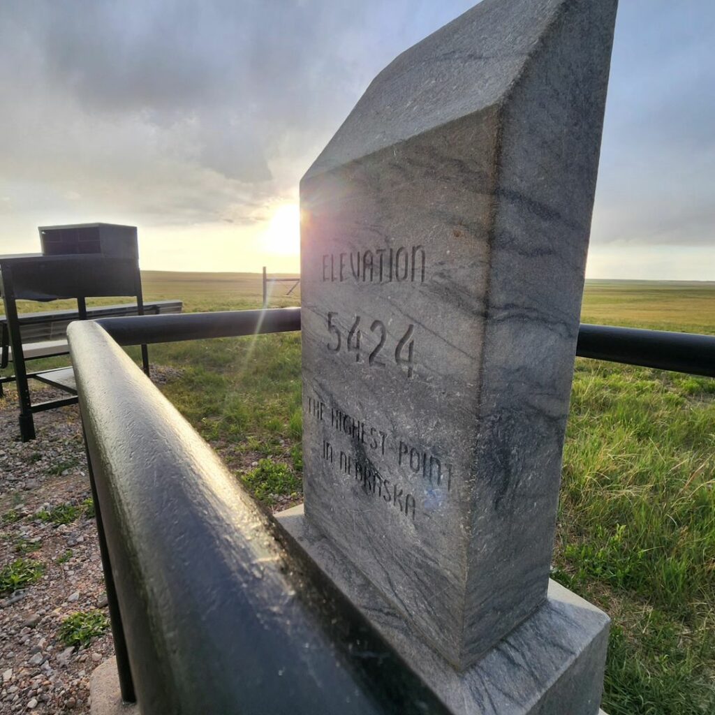
Nebraska | Panorama Point
5,429 feet
Panorama Point offers expansive views of the Nebraska High Plains, featuring vast skies and sprawling prairies. Located on a private ranch, visitors can enjoy the landscape while being mindful of roaming bison. Discovered in 1951 using a World War I altimeter, it represents Nebraska’s contribution to the country’s diverse topographical features.
Fun Fact: Panorama Point is a subtle, nearly imperceptible rise on the high plains near a bison ranch.
Nevada | Boundary Peak
13,140 feet
Boundary Peak, standing in the Boundary Peak Wilderness, offers views extending to landmarks like Mono Lake in California and the Sierra Nevada Mountains. It is the northern end of the White Mountains and shares a twin peak with California’s Montgomery Peak. The surrounding wilderness is home to a variety of plant species, including alpine tundra and bristlecone pines.
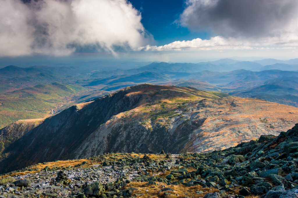
New Hampshire | Mount Washington
6,288 feet
Mount Washington, the highest point in New Hampshire, is also the tallest mountain in northeast North America. Known to Native Americans as Agiocochook, it houses the Mount Washington Cog Railway, leading to the summit where the Sherman Adams Visitor Center offers educational and recreational facilities. On clear days, views extend across several states, showcasing the mountain’s grandeur.
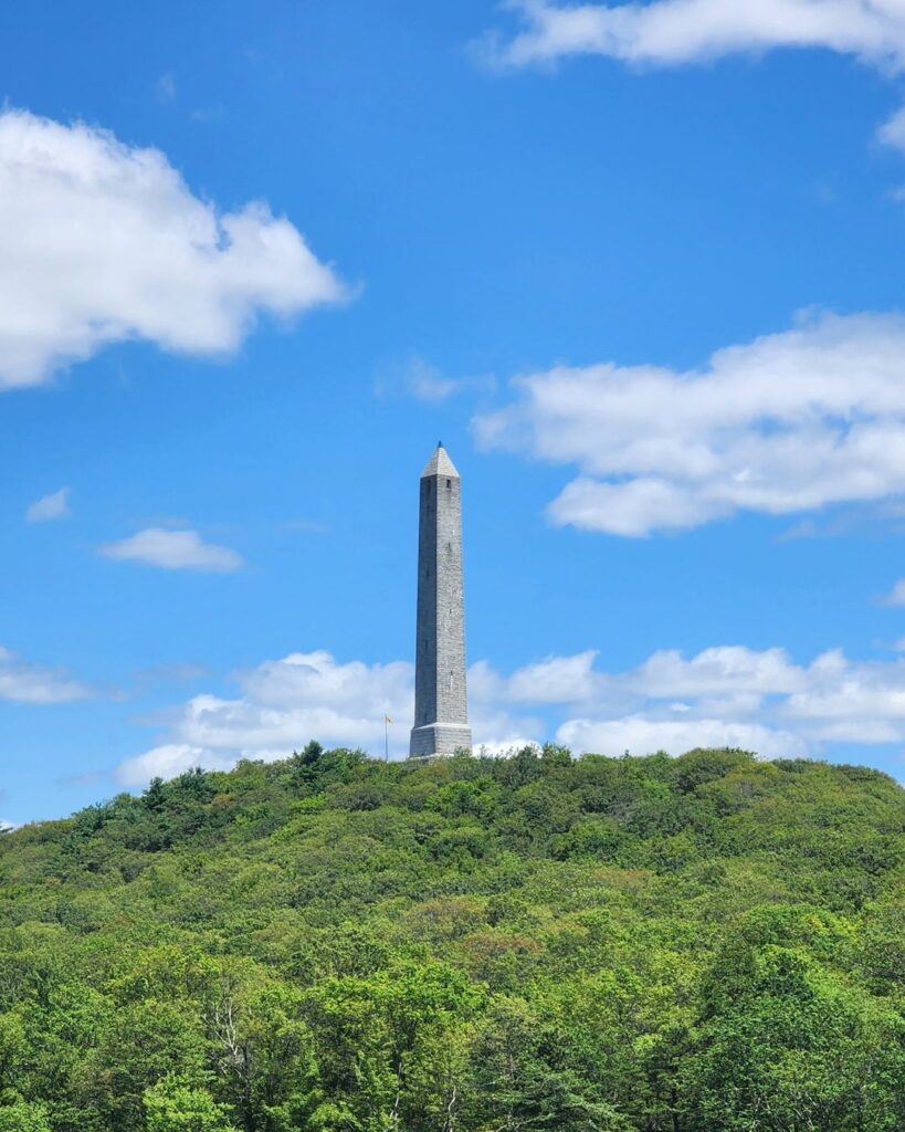
New Jersey | High Point
1,803 feet
High Point, in northern New Jersey, stands as the state’s highest elevation and crowns the Kittatinny Mountains. Within High Point State Park, visitors can explore over 50 miles of trails. The summit is marked by the High Point Monument, a war memorial offering spectacular views from its lookout deck. The park also features an interpretation center, picnic sites, and a campground.
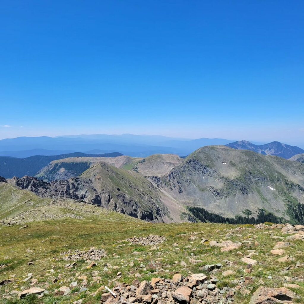
New Mexico | Wheeler Peak
13,161 feet
Wheeler Peak, the highest mountain in New Mexico, rises majestically from the Sangre de Cristo Mountains. The Wheeler Peak Trail, spanning 7.3 miles, winds through the rich ecosystems of the Wheeler Peak Wilderness to the summit. This area is home to diverse wildlife, including elk and golden eagles, and flora such as bristlecone pines and wildflowers, making it a year-round haven for nature enthusiasts.
New York | Mount Marcy
5,344 feet
Mount Marcy presides over New York as the highest point in the state and the Adirondack Mountains. It offers adventurers a variety of trails, presenting different challenges and showcasing endangered alpine vegetation at its summit. The views extend across the Adirondacks, and interestingly, President Teddy Roosevelt was on this peak when he learned he needed to be sworn into office.
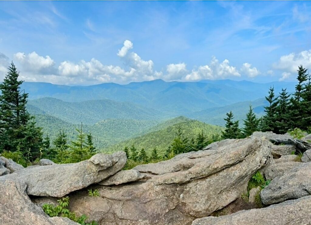
North Carolina | Mount Mitchell
6,684 feet
Mount Mitchell, a beacon for visitors along the Blue Ridge Parkway, is North Carolina’s highest point and the centerpiece of Mount Mitchell State Park. Easily accessible, with a short walk from the parking area to the summit, it offers unparalleled views. Named after Dr. Elisha Mitchell, this mountain is part of the Black Mountains and features educational resources at the Mount Mitchell Museum.
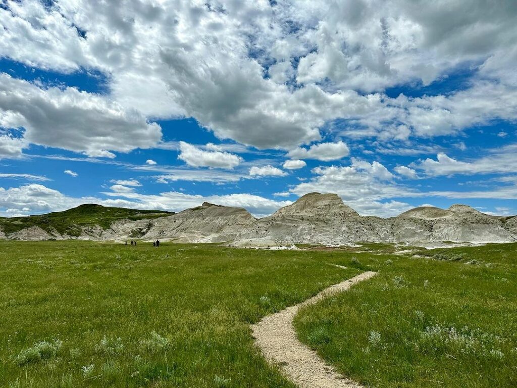
North Dakota | White Butte
3,506 feet
White Butte in Slope County represents North Dakota’s pinnacle within the striking Badlands landscape. Characterized by its distinct color and geological makeup, it echoes the formations found in the Badlands National Park. This serene and remote highpoint offers visitors a unique glimpse into the state’s rugged beauty.
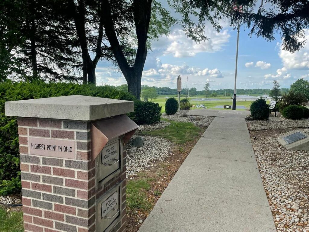
Ohio | Campbell Hill
1,549 feet
Located on the outskirts of Bellefontaine, Campbell Hill is a glacial moraine that marks Ohio’s highest elevation. Once home to the Bellefontaine Air Force Station, it now resides within an educational campus. A simple flagpole marks the summit, alongside a guestbook for visitors to record their journey, reflecting the area’s rich Indian folklore and historical significance.
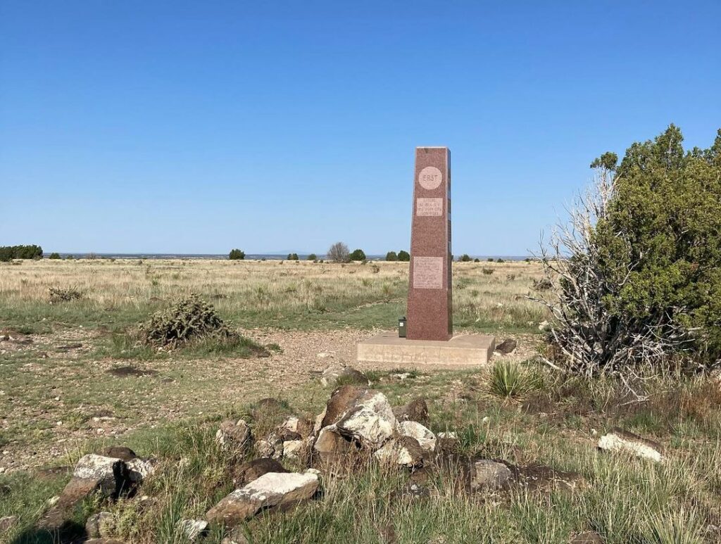
Oklahoma | Black Mesa
4,973 feet
Black Mesa, extending into Colorado and Nevada, represents Oklahoma’s highest point. Named for its layer of black lava rock, it lies within the Black Mesa State Park and Nature Preserve. This unique environment, where the Rockies meet the prairies, is home to several endangered species and offers a prime spot for viewing the Perseid meteor shower each August.
Oregon | Mount Hood
11,249 feet
Mount Hood, a dormant stratovolcano within the Cascade Volcanic Arc, stands as Oregon’s highest peak. Visible from Portland, it is a popular destination for climbers and adventurers, offering activities throughout all seasons. Its slopes feature extensive hiking trails, camping spots, fishing areas, and almost year-round skiing at Timberline Lodge.
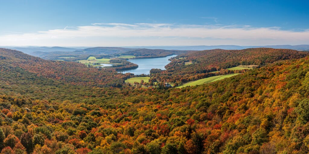
Pennsylvania | Mount Davis
3,213 feet
Located in the Forbes State Forest of southwestern Pennsylvania, Mount Davis is the state’s tallest peak. Named after Civil War veteran John Nelson Davis, a passionate naturalist and surveyor, it offers visitors a trail leading to an observation tower at the summit. The panoramic views from here stretch across the lush Laurel Highlands, showcasing the beauty of Pennsylvania’s natural landscape.
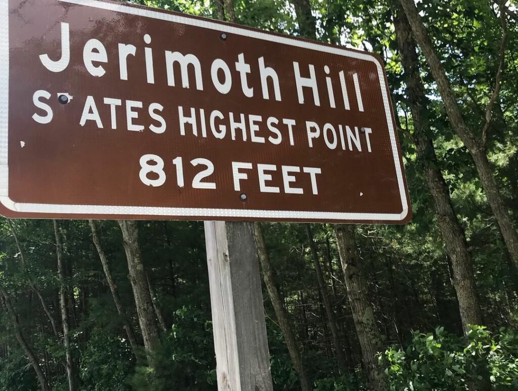
Rhode Island | Jerimoth Hill
811 feet
Reaching Rhode Island’s highest point, Jerimoth Hill in Foster, is now a straightforward journey along a short trail. This accessibility marks a significant change from past when the landowner made access challenging for highpointers. Now publicly owned, the area welcomes all, shedding its reputation for exclusivity.
Fun Fact: Jerimoth Hill is the lowest of all the state highpoints.
South Carolina | Sassafras Mountain
3,553 feet
Sassafras Mountain, straddling the border of South and North Carolina, is enveloped by the expansive Jocassee Gorges. A lookout tower at the summit offers breathtaking views of the surrounding wilderness. Hikers on the Foothills Trail, which spans from Table Rock State Park to Oconee State Park, can enjoy this highpoint as part of their journey through the Carolinas.
South Dakota | Black Elk Peak
7,242 feet
Black Elk Peak, nestled within the Black Elk Wilderness of Custer State Park, stands as the highest point between the Rocky Mountains and the French Pyrenees. Named in honor of the Oglala Lakota medicine man, this peak offers a variety of trails suitable for all ages. The Little Devils Tower trail, in particular, provides views of the Cathedral Spires and Mount Rushmore, highlighting the natural beauty and cultural significance of South Dakota.
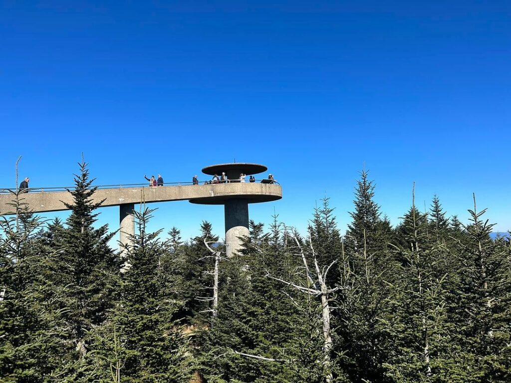
Tennessee | Clingmans Dome
6,643 feet
Clingmans Dome towers above the Great Smoky Mountains, ranking as the third highest peak east of the Mississippi. A scenic road leads visitors to a trailhead, from which a half-mile walk ascends to the summit. The observation tower at the top offers views extending into five states on clear days, and the Appalachian Trail crosses this area, marking the highest point along its route from Georgia to Maine.
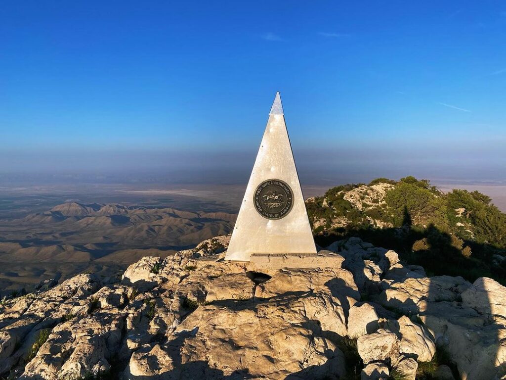
Texas | Guadalupe Peak
8,751 feet
Guadalupe Peak, the “Top of Texas,” is the highlight of Guadalupe Mountains National Park. The 8.4-mile trek to the summit passes through diverse ecosystems, offering hikers a glimpse into the park’s ecological variety. This peak, once submerged under an ancient sea, tells the story of the region’s geological past and evolution over millions of years.
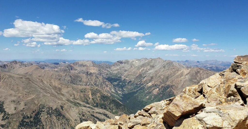
Utah | Kings Peak
13,528 feet
Kings Peak stands as the apex of Utah and the highest peak in the Uinta Mountains. Located in the northeastern part of the state within Ashley National Forest, it is accessible via a challenging 27-mile trail. The trail invites a multi-day backpacking adventure, with opportunities for overnight camping at nearby lakes, highlighting the wilderness and beauty of Utah’s high country.
Vermont | Mount Mansfield
4,393 feet
Mount Mansfield, the highest peak in Vermont, showcases alpine tundra dating back to the Ice Age. Situated within Mount Mansfield State Park and recognized as a National Natural Landmark, it offers a variety of trails and an alternative ascent via the Gondola SkyRide from Stowe Mountain Resort. This destination attracts skiers in winter with its extensive terrain and captivates hikers with its natural beauty year-round.
Virginia | Mount Rogers
5,729 feet
Mount Rogers, nestled within the Mount Rogers National Recreation Area, is traversed by a nine-mile trail through diverse landscapes, including spruce forests and wildflower meadows. Named after Virginia’s first State Geologist, it is surrounded by over 500 miles of trails for hiking, biking, and horseback riding. The region can also be explored via the scenic Mount Rogers Scenic Byway, offering visitors a comprehensive experience of Virginia’s highest point.
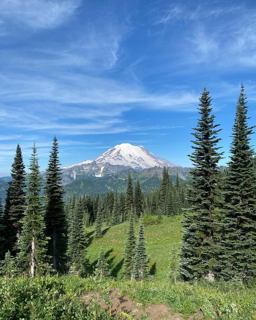
Washington | Mount Rainier
14,410 feet
Mount Rainier, an active volcano and the most glaciated peak in the contiguous United States, dominates the landscape of Mount Rainier National Park. Its snow-capped summit presents a challenging ascent for climbers, while the park’s trails allow less experienced hikers to enjoy the ancient forests and wildflower meadows. The Paradise area of the park, in particular, offers epic views and access to numerous trailheads.
West Virginia | Spruce Knob
4,863 feet
Spruce Knob, the highest point of both West Virginia and the Allegheny Mountains, is a beacon for backpacking and hiking. The Whispering Spruce Trail circles the knob, offering panoramic views of the Spruce Knob-Seneca Rocks National Recreation Area and educating visitors on local geology, flora, and fauna through interpretive signage. This peak exemplifies the rugged beauty of West Virginia’s mountainous terrain.
Wisconsin | Timms Hill
1,951 feet
Located in the town of Hill in northern Wisconsin, Timms Hill is the state’s highest point and a central feature of Timms Hill County Park. From the lookout tower atop the hill, views extend over the Northwoods’ forests and lakes, offering a picturesque landscape. The park, a hub for recreational activities, provides amenities like a fishing pier, swimming beach, and picnic grounds, welcoming visitors to enjoy Wisconsin’s natural beauty throughout the year.
Fun Fact: If you venture up to Timm’s Hill, be sure to stop around the bend at High Point Village to enjoy a delicious home-cooked meal at Hill of Beans. Their large-portion breakfasts are mouth-watering and the Friday night fish fries are legendary!
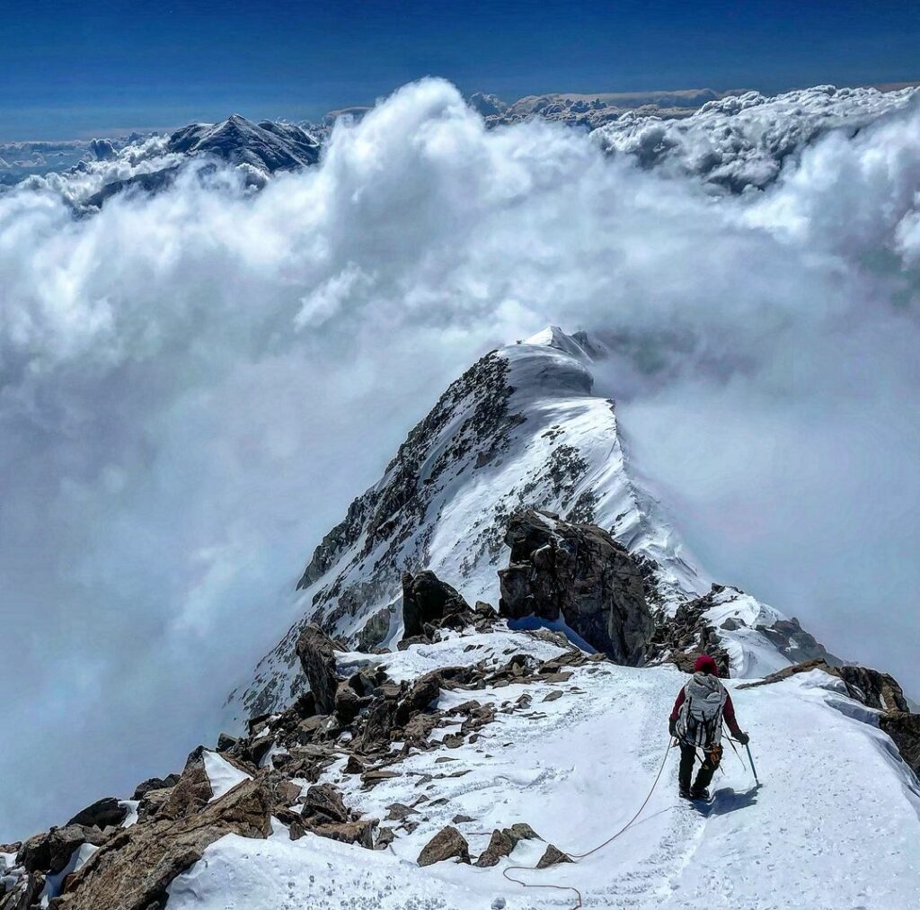
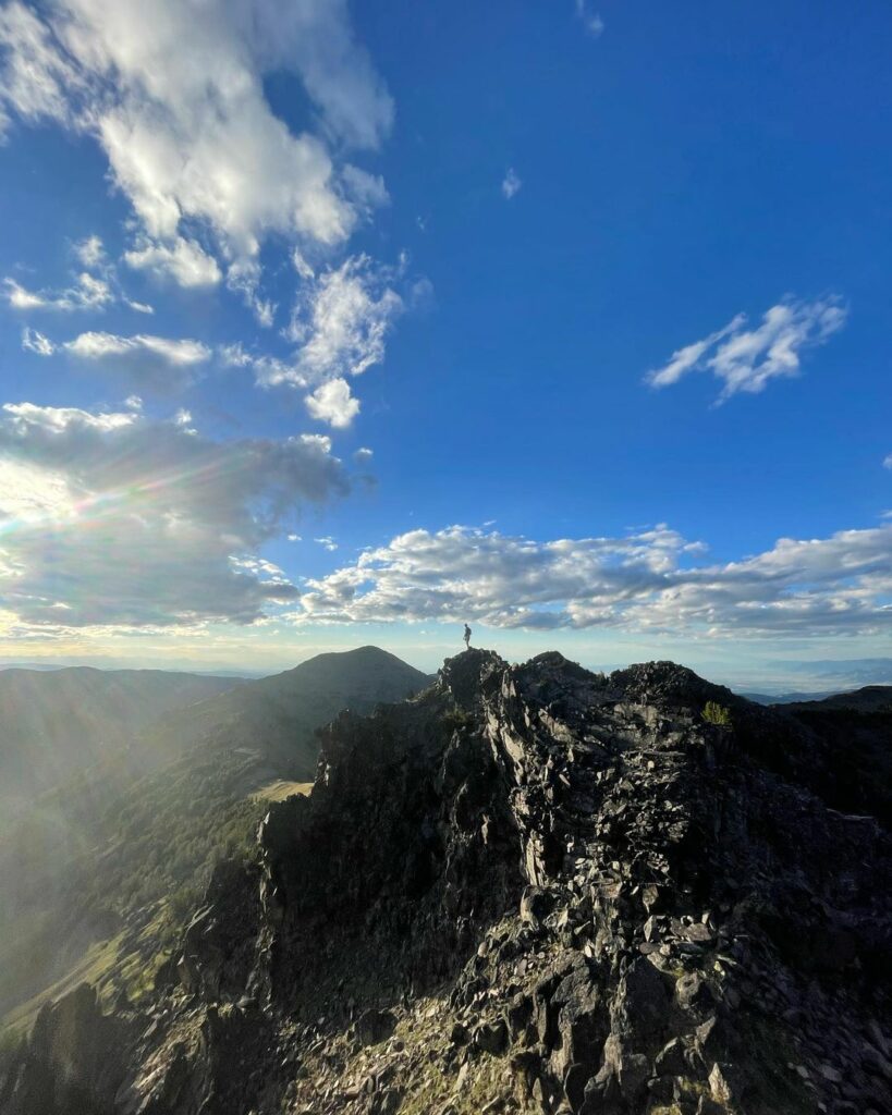
Wyoming | Gannett Peak
13,804 feet
Gannett Peak, situated in the remote Wind River Mountain Range of northern Wyoming, is often cited as one of the most challenging state highpoints to reach. The tallest peak in the Rockies outside of Colorado, it requires navigating high altitude mountain passes and glaciers, including the expansive Gannett Glacier. Adventurers frequently include this peak in their Continental Divide National Scenic Trail explorations, embracing the wild and untamed essence of Wyoming’s high country.
Join the Highpointers Club
Our journey through the highest elevation point in every state showcases the diverse beauty and unique stories that make up the American landscape. From towering mountains to modest hills, each peak offers a glimpse into the geological and cultural tapestry of its region.
Highpointers are adventurers who aim to reach the highest point in each state in the United States, a unique form of peak bagging. This community ranges from casual hikers to serious mountaineers, all sharing the goal of conquering the highest elevations across the country, from the modest hills of the Midwest to the towering giants of Alaska and Colorado.
Highpointing combines the love of hiking, geography, and travel, encouraging people to explore diverse landscapes and often leading them to remote or less-visited areas, and for many, completing all 50 states becomes a lifelong pursuit filled with adventure and personal achievement.
Whether you’re an avid hiker aiming to conquer these summits or a casual traveler seeking new vistas, these highpoints represent more than just numbers on a map. They invite us to explore, to learn, and to appreciate the vast and varied terrain of the United States.
So, pack your gear, set your sights on new heights, and embark on an adventure that elevates your understanding of this vast country.